Perrières | |
|---|---|
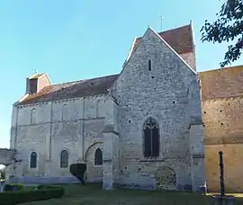 The church in Perrières | |
Location of Perrières | |
 Perrières  Perrières | |
| Coordinates: 48°57′36″N 0°08′06″W / 48.96°N 0.135°W | |
| Country | France |
| Region | Normandy |
| Department | Calvados |
| Arrondissement | Caen |
| Canton | Falaise |
| Intercommunality | Pays de Falaise |
| Government | |
| • Mayor (2020–2026) | Gérard Chandon[1] |
| Area 1 | 8.17 km2 (3.15 sq mi) |
| Population | 339 |
| • Density | 41/km2 (110/sq mi) |
| Time zone | UTC+01:00 (CET) |
| • Summer (DST) | UTC+02:00 (CEST) |
| INSEE/Postal code | 14497 /14170 |
| Elevation | 42–136 m (138–446 ft) (avg. 74 m or 243 ft) |
| 1 French Land Register data, which excludes lakes, ponds, glaciers > 1 km2 (0.386 sq mi or 247 acres) and river estuaries. | |
Perrières (French pronunciation: [pɛʁjɛʁ] ⓘ) is a commune in the Calvados department in the Normandy region in northwestern France.
History
Around 1075, the Lord of Courcy founded a priory under the protection of the Marmoutier Abbey close to Tours.
Population
| Year | Pop. | ±% |
|---|---|---|
| 1962 | 434 | — |
| 1968 | 378 | −12.9% |
| 1975 | 308 | −18.5% |
| 1982 | 269 | −12.7% |
| 1990 | 254 | −5.6% |
| 1999 | 252 | −0.8% |
| 2008 | 276 | +9.5% |
See also
References
- ↑ "Répertoire national des élus: les maires". data.gouv.fr, Plateforme ouverte des données publiques françaises (in French). 9 August 2021.
- ↑ "Populations légales 2021". The National Institute of Statistics and Economic Studies. 28 December 2023.
Wikimedia Commons has media related to Perrières.
This article is issued from Wikipedia. The text is licensed under Creative Commons - Attribution - Sharealike. Additional terms may apply for the media files.